
The First Real Border?
The Roman Era
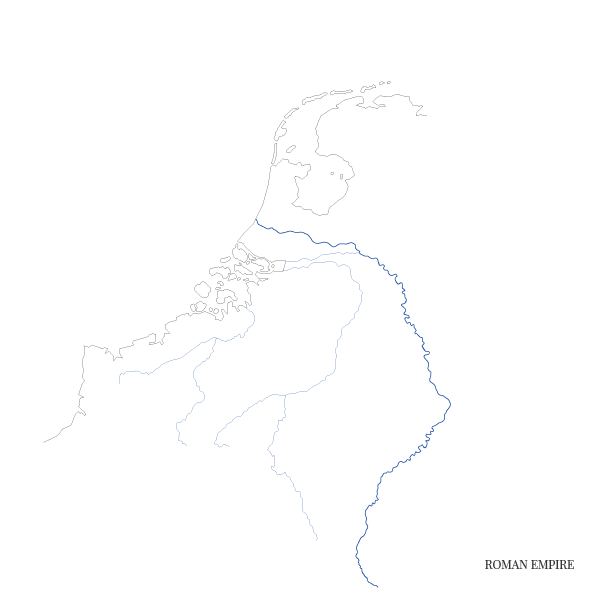
During the Roman Era, modern-day Belgium and lower parts of the Netherlands were contained in the province of Germania inferior. The Roman occupation of the Low Countries lasted from roughly 47 AD to 406 AD. During this period, the river Rhine formed a natural boundary between the Roman territories in the south and the Germanic tribes to the north. To this day, traces of crude border walls called limes can be found in the area, stretching from modern day Katwijk, through Nijmegen to the German city of Bonn.
“When viewed on a map, it is tempting to think of the Rhine as a hard border in the modern sense of the word.”
When viewed on a map, it is tempting to think of the Rhine as a hard border in the modern sense of the word. Historical research, however, has shown this not to be the case. Rather than the border clearly delineating a Roman and a Germanic sphere of influence, the situation on the ground was a lot more fluid. Roman soldiers used the walls and fortifications as forward bases from which they could observe enemy movements and project power northwards. Likewise, the Germanic tribes regularly crossed into Roman-held territories for the purposes of trading, pillaging and even settling land. The practical reality, therefore, was that borders did in fact exist, but only to the degree of one’s ability to enforce them.
